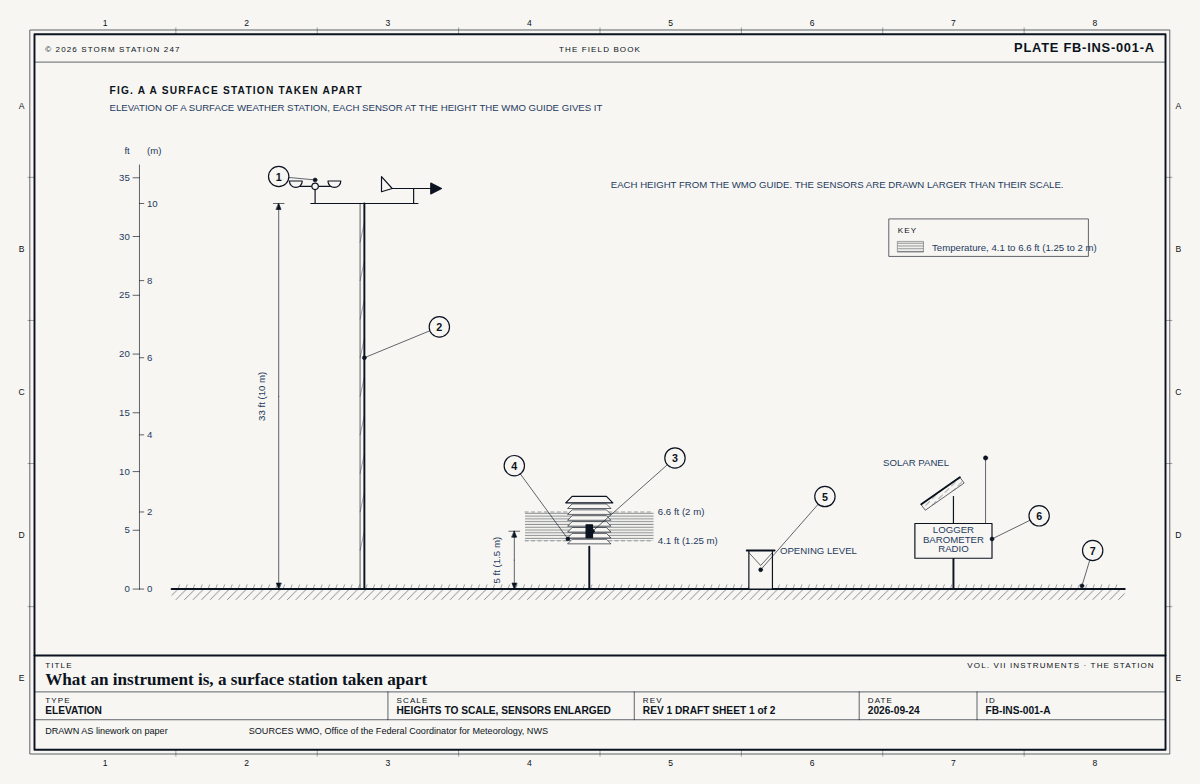
Drawn as the kind of place it stands at. 10 instruments in Virginia stand at one.
What the snow tracker reads here
Every instrument in this state
-in
Snow on the ground
Station charts
Lewisetta Report
Rank 1,464 of 1,554 in Virginia, Oct 17. The 247 rank orders a state's stations by their 247 score out of 100: how reliably they report, how accurate their readings are against a reference station, how their readings pass their checks, and how they stand against the forecast.
Equal scores are ordered by the share of scheduled reports received, then the reports due in the week (the longer record first), then the median arrival, then the longest silence.
Reports receivedweight 3565.422.9 of 35 pointsVirginia median 97.6366 of 560 scheduled reports received in 7 days
Arrivalweight 1034.13.4 of 10 pointsVirginia median 92.7half its reports arrived within 43 min
Continuityweight 1038.83.9 of 10 pointsVirginia median 100.0longest silence 6.3 h, on a schedule of one report every 18 min
Accuracyweight 2089.617.9 of 20 pointsVirginia median 100.0its temperature against the airport station KNUI, 11.0 miles away, over 243 readings: typical difference 3.3 °F beyond a steady offset of +1.4 °F
Instrument checksweight 15100.015.0 of 15 pointsVirginia median 100.00 of 243 readings failed their check against its reference station
Forecast checkweight 10-9.6 of 10 points, at the medianVirginia median 95.7-
The score is the weighted mean of its six parts, from the last 7 days. How a station is ranked sets out each part.
How each part is scored
Reports received
Full marks for every scheduled report received, none for none, in proportion between
Arrival
Full marks for a median arrival within 10 min, none at 60 min
Continuity
Full marks for a longest silence of 3 reports or less (54 min), none for 72 (21.6 h)
Accuracy
Full marks within 2.6 °F of its reference, typically, none beyond 9.1 °F
Instrument checks
Full marks for no reading failed, none for 5 per cent or more
Forecast check
Full marks within 2 °F of the forecast on average, none at 8 °F
364 of 56065.0% of its schedule, 431 reports in all
Days reported, 30 days
-
Longest silence, 7 days
6 h 18 minfrom Oct 14, 9:00 AM
Latest report
Oct 17, 6:00 AMlocal time
Time to reach Storm Station
43 min9 in 10 within 53 min
Against its reference, 30 days
+1.4 °Fwarmer than the airport station KNUI, 11 miles away, on average over 255 readings; typical difference 3.5 °F
From Storm Station's own record of every report it heard from this station.
Against its reference: each temperature this station reports is compared with the nearest airport or climate reference station that reported within half an hour, up to 15 miles away. The figure is its reading less the reference's, on average, as both were reported; the typical difference is the root mean square. The difference in height is shown where both heights are known.
Its schedule is one report every 18 min, 80 in 24 hours. Two reports in the same 18 min count as one received.
The ranking these charts were drawn from, as tables
Share of scheduled reports received
Stations
100%
382
90 to 99%
521
80 to 89%
158
70 to 79%
120
60 to 69%
37
50 to 59%
177
40 to 49%
85
30 to 39%
7
20 to 29%
17
10 to 19%
46
0 to 9%
4
Day
Rank
Stations ranked
Share received
Oct 17, 2026
1,464
1,554
65.3%
Oct 16, 2026
1,468
1,541
57.6%
Oct 15, 2026
1,467
1,532
47.6%
Oct 14, 2026
1,464
1,537
42.1%
Oct 13, 2026
1,470
1,536
32.6%
Oct 12, 2026
1,498
1,532
22.5%
Oct 11, 2026
1,515
1,520
11.6%
Station report
Lewisetta, in 2 sheets
Drawn from the register, in the manner of the Field Book, and opened beside the plates that explain each part of it.
On Oct 17 the noon sun stands 43 degrees above the horizon at 37.99 N, and the day is 11 h 00 min long. Level ground there takes 68 per cent of the noon sunlight a surface facing the sun would.
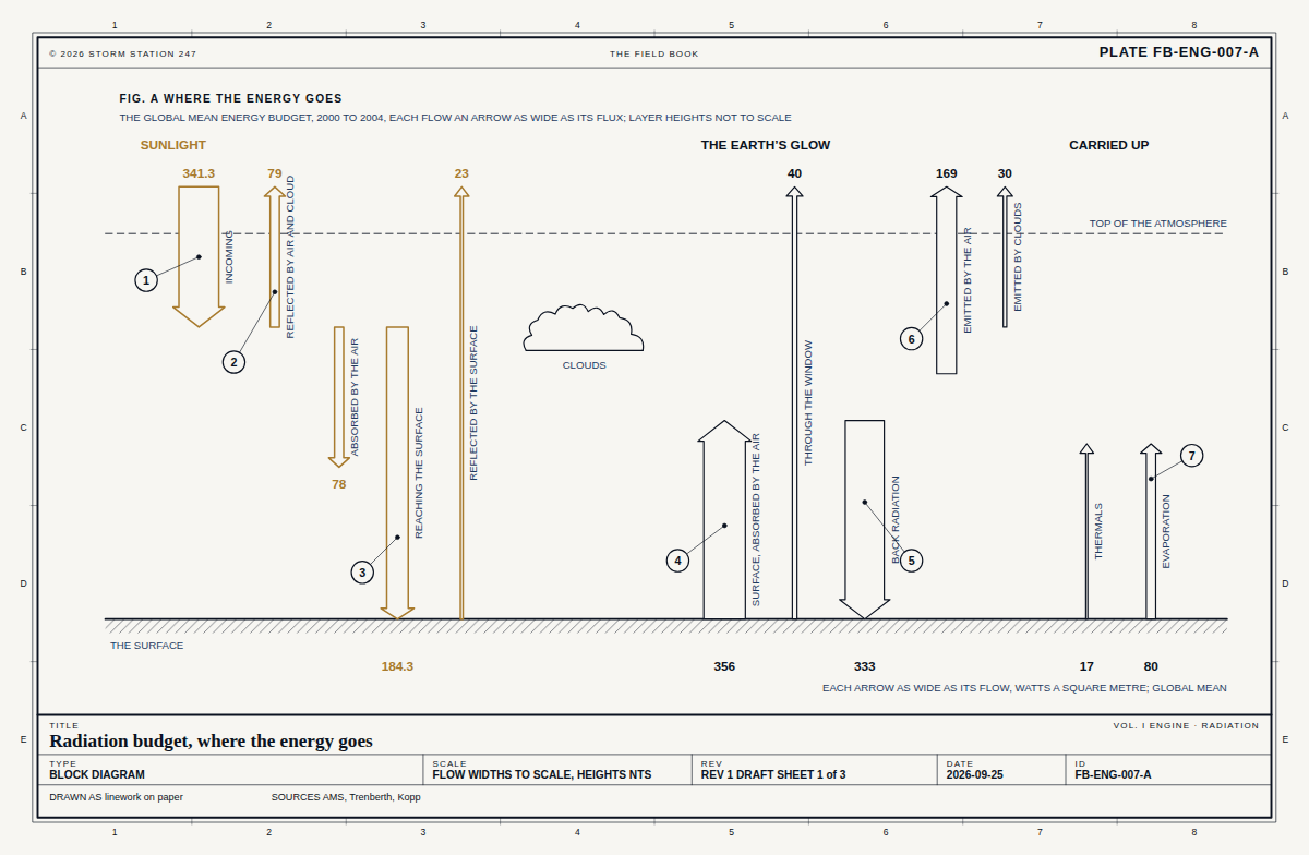 FB-ENG-007, Fig. ARadiation budget