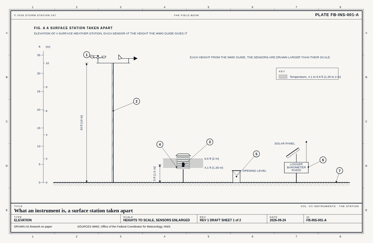
Drawn as the kind of place it stands at. 104 instruments in Arizona stand at one.
What the snow tracker reads here
Every instrument in this state
-in
Snow on the ground
Station charts
Gila River Below Coolidge Dam Report
Rank 298 of 1,853 in Arizona, Oct 17. The 247 rank orders a state's stations by their 247 score out of 100: how reliably they report, how accurate their readings are against a reference station, how their readings pass their checks, and how they stand against the forecast.
Ranking Statistics
247 score97.1of 100
Arizona median
88.7the median score of 1,853 stations
Scoring higher
293stations in Arizona
Sharing its score
25ranks 294 to 318
Points deducted
2.91.6 arrival, 0.9 forecast check, 0.4 accuracy
Counted at the median
Accuracy, instrument checks, forecast checknot measured at this station; Arizona median 98.0, 100.0, 91.0
Next above
QWSA3rank 297; ahead on median arrival 17 min 51 s against 17 min 56 s
Next below
QFLA3rank 310; behind on reports received 100% against 99.4%
Sharing its rank
11other stations, equal on every measure
Equal scores are ordered by the share of scheduled reports received, then the reports due in the week (the longer record first), then the median arrival, then the longest silence.
Reports receivedweight 35100.035.0 of 35 pointsArizona median 83.9168 of 168 scheduled reports received in 7 days
Arrivalweight 1084.18.4 of 10 pointsArizona median 78.4half its reports arrived within 18 min
Continuityweight 10100.010.0 of 10 pointsArizona median 100.0longest silence 60 min, on a schedule of one report every 60 min
Accuracyweight 20-19.6 of 20 points, at the medianArizona median 98.0-
Instrument checksweight 15-15.0 of 15 points, at the medianArizona median 100.0-
Forecast checkweight 10-9.1 of 10 points, at the medianArizona median 91.0-
The score is the weighted mean of its six parts, from the last 7 days. How a station is ranked sets out each part.
How each part is scored
Reports received
Full marks for every scheduled report received, none for none, in proportion between
Arrival
Full marks for a median arrival within 10 min, none at 60 min
Continuity
Full marks for a longest silence of 3 reports or less (3 h), none for 72 (72 h)
Accuracy
Full marks within 1.5 °F of its reference, typically, none beyond 8.0 °F
Instrument checks
Full marks for no reading failed, none for 5 per cent or more
Forecast check
Full marks within 2 °F of the forecast on average, none at 8 °F
At 2,311 ft above sea level, 8 per cent of the atmosphere's air lies below the station. The standard atmosphere puts the pressure there at 27.51 inHg and the temperature at 50.8 F.
On Oct 17 the noon sun stands 47 degrees above the horizon at 33.17 N, and the day is 11 h 10 min long. Level ground there takes 74 per cent of the noon sunlight a surface facing the sun would.
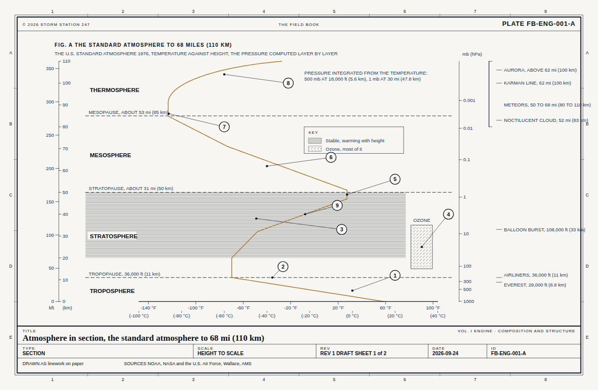 FB-ENG-001, Fig. AAtmosphere in section
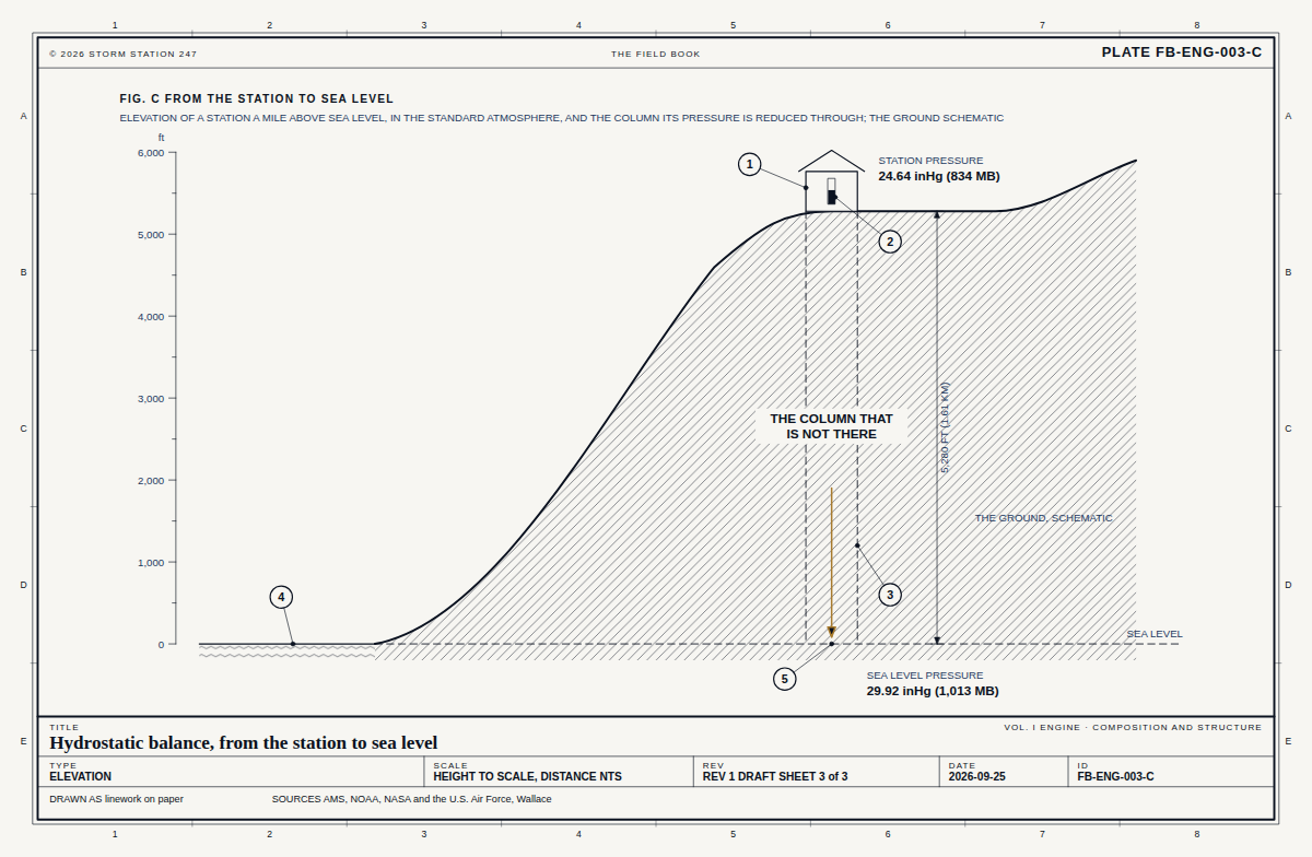 FB-ENG-003, Fig. CHydrostatic balance